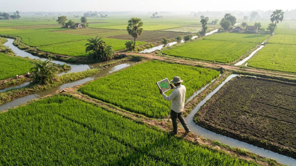
Geospatial agritech startup FarmwiseAI completes high-resolution boundary mapping of 40 million agricultural parcels in Tamil Nadu for crop monitoring and credit underwriting.
Executive Key Takeaways
- FarmwiseAI has successfully mapped 40 million agricultural land parcels across all 38 districts of Tamil Nadu with sub-meter spatial accuracy.
- The platform leverages synthetic aperture radar (SAR) and computer vision models to monitor crop health independent of cloud cover or weather friction.
- Public and private banking institutions in the state are integrating the geospatial records to compress agri-loan underwriting from 14 days to 48 hours.
FarmwiseAI Maps 40 Million Land Parcels in Tamil Nadu Using Satellite Geospatial Intelligence and Computer Vision represents one of the largest geospatial digital agriculture initiatives completed in South Asia. Agritech and spatial analytics pioneer FarmwiseAI has successfully delineated and indexed more than 40 million rural and agricultural land parcels spanning all 38 administrative districts of Tamil Nadu, creating an exhaustive, real-time spatial digital twin of the state's agrarian economy.
Accurate land boundary delineation and real-time crop monitoring have historically stood as major structural bottlenecks for agricultural finance, crop insurance distribution, and state welfare governance. Fragmented land records and manual on-ground revenue inspections often resulted in prolonged loan approval timelines and delayed disaster compensation. FarmwiseAI's computer-vision-driven mapping framework resolves these challenges, delivering verified spatial intelligence at unprecedented scale.
Neural Edge Delineation & All-Weather Radar Telemetry
Mapping 40 million fragmented parcels—many measuring under an acre and divided by irregular earthen bunds—presented monumental computational challenges. Traditional manual surveying or basic optical satellite analysis is hindered by seasonal cloud cover during the Northeast and Southwest monsoons, precisely when crop growth is most active.
FarmwiseAI addressed this by building a multi-sensor sensor fusion architecture:
- All-Weather Synthetic Aperture Radar (SAR): By integrating active microwave radar imagery from Sentinel-1 and commercial constellations, the system penetrates monsoon clouds, precipitation, and nighttime darkness, ensuring uninterrupted weekly soil moisture and canopy growth monitoring.
- Sub-Pixel Deep Learning Edge Detectors: Convolutional neural networks trained on millions of annotated Indian farm plots identify natural boundaries, ridge bunds, irrigation canals, and tree lines with sub-meter spatial precision.
- Dynamic Crop Phenology Tracking: The platform matches spectral reflectance data against known crop phenology curves to automatically identify whether a parcel is cultivated with paddy, sugarcane, cotton, pulses, or horticultural crops.
"To empower India's smallholder farmers with institutional credit, digital agriculture must begin with accurate, verifiable parcel geometry,"stated the founders of FarmwiseAI. "By transforming satellite radar telemetry into living field dossiers for 40 million plots, we are giving farmers a recognized digital asset that unlocks rapid credit and automated disaster protection."
Institutional Integration & Operational Metrics
The mapped database is already integrated into the digital underwriting engines of leading public sector lenders, regional rural banks, and cooperative credit societies across Tamil Nadu.
The structured table below summarizes the operational telemetry and measurable socioeconomic impact of the 40-million-parcel dataset:
| Agricultural Data Dimension | Prior Manual Baseline | FarmwiseAI Geospatial Platform | Systemic Institutional Impact |
|---|---|---|---|
| Parcel Delineation Accuracy | Subjective Manual Cadastral Maps | Sub-Meter Verified Bound Geometries | Tamper-Proof Digital Land Ledger |
| Loan Underwriting Timeline | 14 to 21 Days (Manual Field Survey) | Under 48 Hours Digital Verification | 85% Compression in Credit Approval Cycle |
| Crop Health Telemetry Frequency | Once per Season (Self-Reported) | Continuous 5-Day Radar Revisit | Real-Time Pest & Drought Detection |
| Disaster Assessment Turnaround | 6 to 8 Weeks Post-Cyclone | 72 Hours Automated Damage Heatmaps | Rapid Direct Benefit Transfer (DBT) Payouts |
| Geographic Coverage | Sample Surveys (Under 5% Plots) | 100% Coverage Across 38 Districts | Complete Macroeconomic Agriculture Visibility |
Catalyzing the Digital Agriculture Ecosystem
The completion of Tamil Nadu's parcel database establishes a foundational data layer for the broader agritech and rural enterprise landscape. By standardizing digital parcel identities, startups in precision irrigation, drone spraying, and farm-to-fork supply chains can interface with farmers using unambiguous geospatial coordinates, reducing logistical friction.
This milestone complements broader Indian initiatives in autonomous remote sensing and sovereign infrastructure, including indigenous satellite imaging innovations and logistics robotics partnerships across frontline tech hubs.
Expansion Roadmap Across Peninsular India
Following the successful completion of the Tamil Nadu deployment, FarmwiseAI has initiated pilot boundary delineation projects across Andhra Pradesh, Telangana, and Karnataka, targeting an additional 65 million agricultural parcels over the next 18 months.
As India modernizes its rural economy, verified geospatial intelligence bridges the historical information divide between farmers and formal financial institutions. FarmwiseAI's 40-million-parcel milestone demonstrates how deeptech artificial intelligence can create tangible, systemic socioeconomic value across India's agricultural heartland.
Frequently Asked Questions
How does FarmwiseAI map agricultural plot boundaries with high precision?
FarmwiseAI combines European Space Agency (ESA) Sentinel radar telemetry, high-resolution commercial optical satellite feeds, and proprietary computer vision edge-detection neural networks. The models recognize field bunds, natural drainage channels, and tree line partitions to delineate sub-meter plot boundaries without requiring physical ground surveyor visits.
What is the advantage of using Synthetic Aperture Radar (SAR) over standard satellite imagery?
Traditional optical satellite imagery is frequently obstructed by dense cloud cover during critical monsoon planting and harvest seasons. SAR radar signals penetrate cloud layers, haze, and nighttime darkness, enabling continuous, weekly crop health telemetry throughout the entire farming cycle.
How do banking institutions utilize FarmwiseAI's mapped data for agricultural loans?
Banks utilize the platform's farm intelligence score to verify land ownership, evaluate historical crop yield stability, assess flood and drought risk, and authenticate cultivation practices. This replaces slow, paper-heavy field inspections with instant digital credit verification.
Does the system support state government crop insurance programs?
Yes, state agriculture departments and insurance underwriters utilize FarmwiseAI's automated vegetation indices to assess crop damage following cyclones, floods, or drought spells, enabling rapid, objective direct benefit transfers (DBT) to affected farmers.
Primary Sources & Official References
- FarmwiseAI Technical Whitepaper on Scaled Agricultural Boundary Detection: Deep learning spatial architectures and satellite telemetry methodologies (https://www.farmwise.ai).
- Tamil Nadu e-Governance Agency (TNeGA) Geospatial Data Initiatives: State spatial data policies and digital land administration benchmarks (https://tnega.tn.gov.in).
- National Bank for Agriculture and Rural Development (NABARD) Digital Agri-Lending Guidelines: Technical standards for remote agricultural risk assessment (https://www.nabard.org).