Bengaluru Engineer Builds AI App to Detect Potholes and Pinpoint Civic Repair Accountability
By Sanjay Patel | Published August 19, 2026 | 7 min read
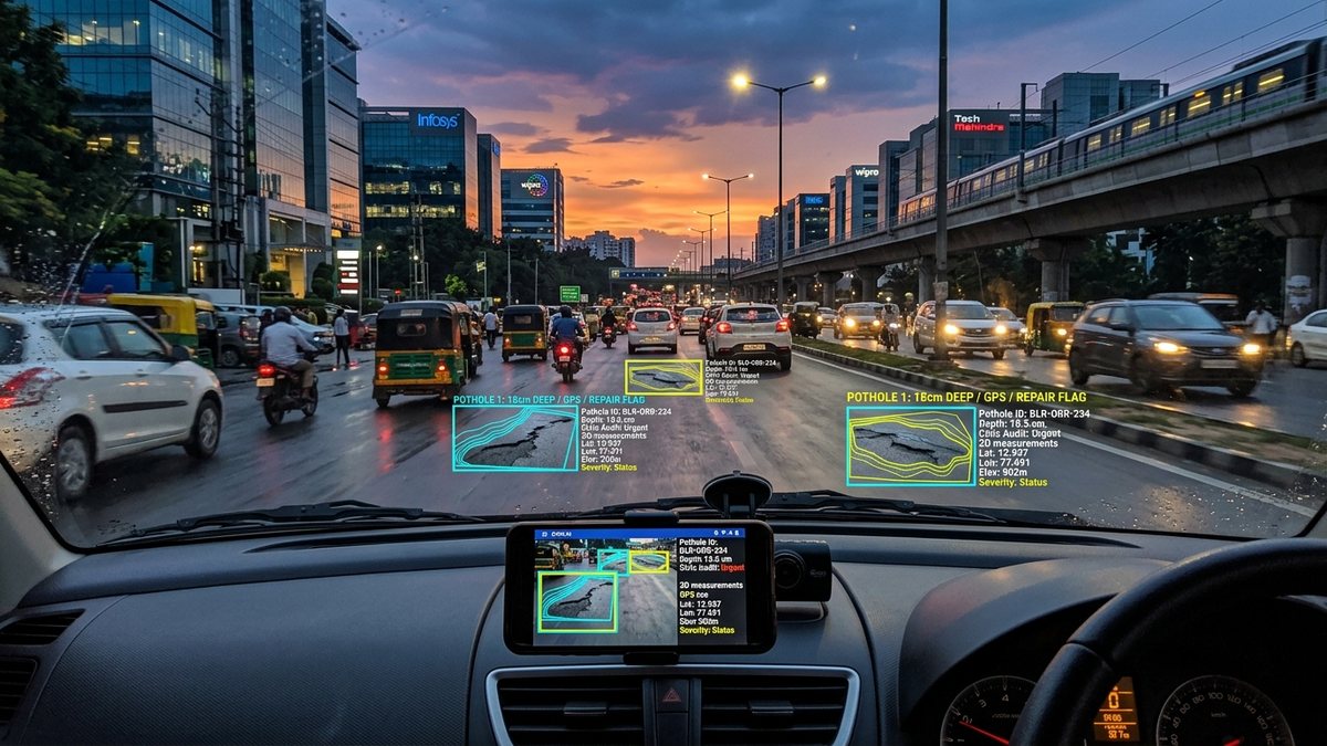
Using dashcams, smartphone sensors, and real-time computer vision, a Bengaluru engineer has built an AI system that automatically maps potholes, classifies road damage, and assigns contractor responsibility.
Leveraging computer vision, sensor fusion, and open municipal data to tackle one of India's most chronic urban infrastructure crises, a Bengaluru-based software engineer has engineered an autonomous AI-powered pothole detection and civic accountability platform. Mounted simply via a dashboard smartphone or dashcam, the system captures real-time video feeds, classifies road surface defects, and cross-references geographical coordinates against municipal contractor jurisdiction databases.
The open civic tech initiative addresses the systemic breakdown in urban road maintenance: delayed defect reporting, lack of objective damage measurement, and ambiguous contractor accountability across municipal ward boundaries.
The Engineering Architecture: Sensor Fusion Meets Edge Computer Vision
The pothole detection platform operates on an edge-compute architecture, processing video frames directly on the user's mobile device to minimize bandwidth consumption while maintaining sub-second defect classification.
| Architectural Component | Technology Implementation | Function & Performance |
|---|---|---|
| Edge Vision Model | Quantized YOLOv11 / MobileNet-V4 | Detects potholes, alligator cracking, and manhole depressions at 30 FPS |
| Sensor Fusion Engine | 3-Axis Accelerometer + Gyroscope (IMU) | Measures vertical g-force shock impacts to quantify pothole depth and severity |
| Spatial Mapping | RTK-assisted GPS & OpenStreetMap (OSM) | Geo-tags potholes with sub-1-meter location precision |
| Civic Ward Correlator | GIS Spatial Query Engine | Maps coordinates to exact BBMP/Municipal ward zones and active contractor warranty files |
| Public Dashboard API | Vector Tiles & Automated Webhooks | Automatically generates municipal repair tickets and publicly tracks resolution SLA |
Automated Contractor Attribution and Warranty Tracking
A major innovation of the platform is its automated civic audit database. In most urban centers, road resurfacing contracts include a mandatory 3-year defect liability period (DLP), during which the contracting firm is legally obligated to repair surface degradation at zero public cost. However, due to fragmented record-keeping, public works departments frequently issue duplicate repair tenders at taxpayer expense.
"Civic problems in our cities are rarely due to a lack of engineering talent; they stem from information asymmetry and broken accountability loops,"noted the project's lead engineer. "By turning everyday commuter dashcams into a distributed road audit network, we eliminate disputes over when a pothole formed, how deep it is, and exactly which contractor's warranty covers the repair."
The app assigns a 1-to-10 Severity Index to each detected road defect by fusing the optical area of the pothole with the vertical accelerometer jolt experienced by passing vehicles.
Key System Capabilities:
1. Crowdsourced Real-Time Road Health Heatmaps: Aggregating thousands of daily commuter trips into a live, color-coded road quality index accessible to navigation apps and civic authorities.
2. Automated Ticket Filing via Open Civic APIs: Automatically dispatching timestamped photographic evidence, GPS coordinates, and depth telemetry to municipal redressal portals.
3. Contractor Defect Liability Tracking: Flagging whether the damaged road segment falls within an active contractor warranty, preventing unnecessary re-tendering of public funds.
The Expanding Role of Civic Tech and Connected Mobility
The initiative reflects the broader convergence of automotive telematics, computer vision, and civic governance. As detailed in our analysis of India's software-defined mobility platform evolution, connected vehicles and edge AI devices are becoming powerful distributed sensory networks for smart city management.
With civic advocacy groups and resident welfare associations (RWAs) across Bengaluru, Pune, and Hyderabad now piloting the software, the platform demonstrates how grassroots engineering ingenuity can bring unprecedented transparency to urban infrastructure governance.