Drone Tech Startup Deploys Aerial Fleet to Support Emergency Rescue Operations in Flood-Hit Gujarat
By Sanjay Patel | Published July 28, 2026 | 8 min read
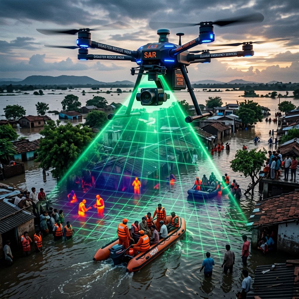
An Indian drone-tech startup is using autonomous thermal-imaging and payload-delivery UAVs to assist emergency teams in saving lives during severe flooding across Gujarat.
Amid severe monsoon flooding across multiple low-lying coastal and rural districts in Gujarat, an indigenous disaster-tech and autonomous drone startup has deployed a fleet of heavy-lift UAVs equipped with infrared thermal vision cameras, emergency satellite communicators, and automated winch payload release systems to assist the National Disaster Response Force (NDRF) and local administration in real-time search and rescue operations.
The aerial fleet has proven vital in navigating submerged terrain, dense tree canopies, and submerged roadways where traditional boats and ground rescue units cannot safely operate.
Aerial Disaster Management & Thermal Infrared Search
During severe flood events, murky water conditions and nightfall severely restrict conventional search-and-rescue visibility. The deployed rescue drones operate autonomously across pre-mapped GPS grids, utilizing dual-camera gimbals featuring high-resolution optical zoom paired with FLIR thermal imaging sensors.
The thermal cameras detect human body heat signatures through thick foliage and dark floodwaters, automatically transmitting pinpoint GPS coordinates to ground rescue boats.
Emergency Drone Fleet Capabilities & Technical Specs
| Operational Module | UAV Technical Specification | Mission & Emergency Function |
|---|---|---|
| Flight Endurance & Range | 45-minute continuous flight per pack | Covers up to 15 sq km per mission sortie |
| Payload Capacity | Up to 12kg heavy payload winch | Delivers medical kits, life jackets, emergency rations |
| Thermal Sensing | 640x512 Radiometric Thermal Sensor | Identifies human heat signatures in total darkness & heavy rain |
| All-Weather Rating | IP67 Waterproof & Wind Resistant | Operates safely in sustained 45 km/h gale-force winds |
| Satellite Uplink | Direct SATCOM Telemetry Link | Transmits live video streams even when cell towers are down |
Visualizing Aerial Search & Emergency Operations
The visual graphic above showcases the autonomous rescue drone in action, hovering over flooded inundation zones while streaming real-time thermal telemetry to NDRF control rooms on shore.
Engineering Resilient Hardware for Harsh Weather
Engineering lead Rohan Mehta emphasized that operating drones during tropical monsoon conditions required custom sealed carbon-fiber frames, hydrophobic lens coatings, and redundant dual-battery fail-safes:
"Disaster relief technology cannot afford single-point failures,"stated Mehta. "Our UAVs are engineered specifically for tropical extreme weather, ensuring emergency teams have continuous eyes in the sky when lives are on the line."
Strategic Alignment with India's Deep-Tech Hardware Surge
The successful deployment of disaster relief drones highlights the practical impact of India’s growing deep-tech hardware ecosystem, aligning with recent developments featured in our analysis of the Gujarat LoRa-RISC-V Hardware Collaboration and breakthroughs showcased at the Bengaluru Nano Summit Deep-Tech Showcase.
With over 120 flood victims located and rescued during initial 48-hour operations, the Gujarat deployment sets a new national standard for integrating autonomous robotics into emergency management.