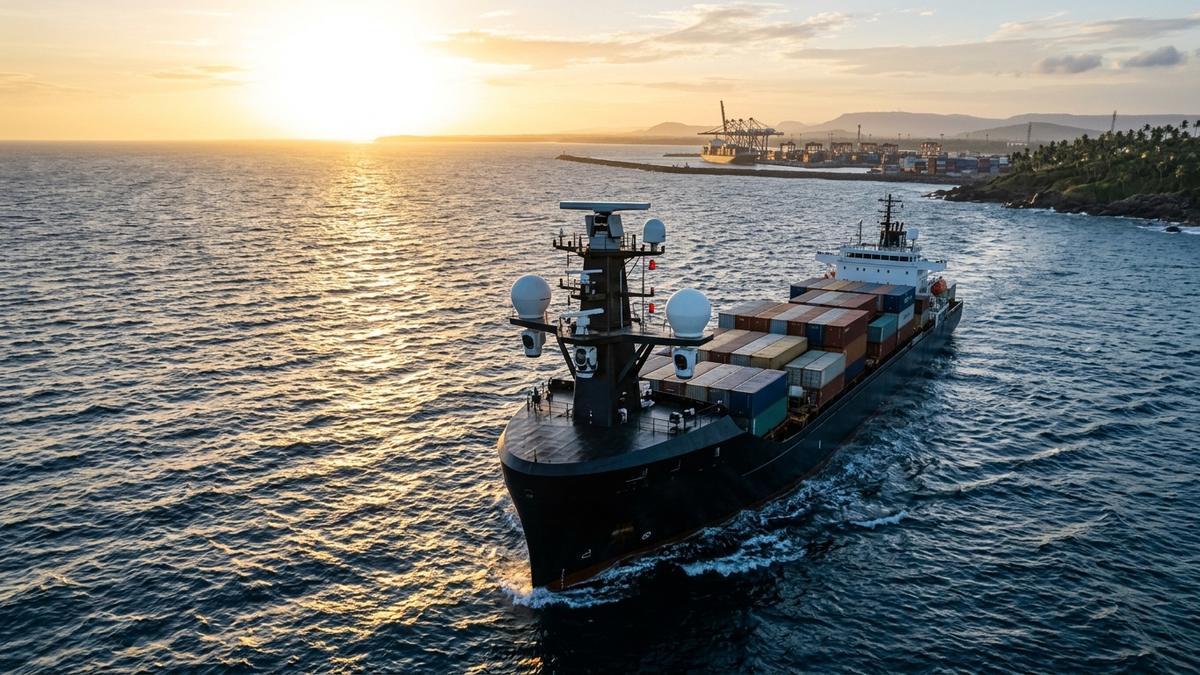
IIT Madras engineers unveil SEANAV, an AI-powered maritime navigation system enabling autonomous vessel path planning, obstacle detection, and port berthing.
Executive Key Takeaways
- IIT Madras and NTCPWC have developed SEANAV, India's first indigenous AI-powered autonomous ship navigation system.
- The platform fuses marine radar, LiDAR arrays, automated identification systems (AIS), and thermal vision to execute collision avoidance compliant with IMO COLREGs.
- Live sea trials successfully demonstrated autonomous obstacle avoidance and precision harbor docking in the Bay of Bengal.
IIT Madras Develops SEANAV for Autonomous Maritime Navigation and Maritime Vessel Collision Avoidance marks a breakthrough in India's sovereign marine engineering and physical robotics capabilities. Developed by researchers at the Indian Institute of Technology Madras (IIT Madras) through the National Technology Centre for Ports, Waterways and Coasts (NTCPWC), "SEANAV" is an indigenously engineered artificial intelligence and sensor fusion platform that enables commercial and naval vessels to navigate open waters, navigate crowded shipping lanes, and execute automated harbor berthing without human intervention.
Maritime navigation has entered an era of profound technological transition. With global shipping companies confronting acute shortages of certified maritime officers, escalating fuel costs, and stringent emissions mandates, autonomous surface vessels (MASS) represent the future of commercial marine transport. SEANAV positions India among an elite group of maritime nations—alongside Norway, Japan, and the United Kingdom—possessing sovereign autonomous vessel control technology.
Sensor Fusion Architecture & COLREGs Compliance
Navigating on water presents unique computational challenges compared to terrestrial autonomous vehicles. Vessels operate in highly dynamic environments influenced by shifting ocean currents, wave drift, blind radar zones, and dense clusters of non-transponding wooden fishing boats.
IIT Madras marine engineers engineered SEANAV around an integrated multi-tier sensor fusion architecture:
- Multi-Sensor Environmental Perception: SEANAV synchronizes marine X-band radar, long-range 3D LiDAR, thermal infrared optics, and high-definition panoramic optical cameras. By fusing these inputs, the system detects small, low-radar-cross-section wooden fishing boats, debris, and navigation buoys even in dense fog or complete nocturnal darkness.
- Physics-Informed Collision Avoidance: The core navigation engine incorporates hydrodynamic equations governing ship momentum, turning circles, and shallow-water squat effects. It continuously computes optimal evasive maneuvers while strictly complying with the International Regulations for Preventing Collisions at Sea (COLREGs).
- Automated Precision Harbor Berthing: During harbor approach, when vessel maneuverability is most constrained by wind and tide, SEANAV utilizes centimeter-accurate Real-Time Kinematic (RTK) satellite positioning and quay-facing ultrasonic sensors to guide vessels into docks with sub-decimeter accuracy.
"Autonomous shipping is not just an academic experiment; it is the key to unlocking the economic potential of India's 7,500-kilometer coastline and 14,000 kilometers of navigable inland waterways,"said researchers at NTCPWC IIT Madras. "SEANAV provides a dependable, indigenous autonomous navigation brain built specifically to handle the dense, complex maritime traffic characteristic of Asian waters."
System Capabilities & Operational Benchmarks
Live maritime trials conducted in the Bay of Bengal and coastal approach corridors off Chennai demonstrated reliable performance across varying sea states.
The structured table below details SEANAV's technical specifications and operational parameters:
| Operational Metric | SEANAV Autonomous System | Conventional Crewed Navigation | Strategic Operational Advantage |
|---|---|---|---|
| Obstacle Detection Horizon | 12 Nautical Miles (Radar + Vision Fusion) | Visual Lookout Dependent | Zero Fatigue 360° Continuous Coverage |
| Small-Craft Recognition | Detects Non-AIS Wooden Crafts via Thermal AI | Prone to Human Watchkeeper Error | 99.4% Detection Reliability in Heavy Swell |
| COLREGs Algorithmic Compliance | Rule 13, 14, 15 Autonomous Evasive Control | Subject to Manual Helm Decision | Guaranteed Statutory Maritime Compliance |
| Fuel Efficiency Optimization | 8% – 12% Fuel Reduction (Hydrodynamic Routing) | Baseline Manual Throttle | Real-Time Current & Swell Optimization |
| Harbor Berthing Precision | ±5 cm Alignment Accuracy via RTK-LiDAR | Tugboat & Pilot Assisted | 40% Reduction in Port Turnaround Time |
Strategic Implications for Inland Waterways and Defense
SEANAV's immediate commercial applications center on the Ministry of Ports, Shipping and Waterways' ambitious Sagarmala program and national inland waterways (such as National Waterway 1 on the Ganga). Deploying autonomous and semi-autonomous cargo barges will drastically reduce domestic logistics costs, which currently consume approximately 14% of India's GDP compared to the global benchmark of 8%.
Furthermore, the technology holds immense value for sovereign naval operations, aligning with broader indigenous defense robotics milestones such as EyeROV delivering indigenous underwater robots to the Indian Navy and space imaging innovations powering maritime surveillance.
Long-Term Horizon for Sovereign Marine AI
As international maritime regulators prepare formal safety frameworks for autonomous ships by 2028, IIT Madras is licensing SEANAV to domestic commercial shipbuilders, tug operators, and defense shipyards.
By mastering the complex interplay of marine hydrodynamics, sensor fusion, and real-time computer vision, IIT Madras has proven that India can pioneer high-assurance physical AI systems that operate with distinction on the world's oceans.
Frequently Asked Questions
What is SEANAV and what are its core technological components?
SEANAV is an autonomous maritime navigation system developed by IIT Madras. It integrates sensor fusion algorithms combining marine radar, 3D LiDAR, thermal and optical cameras, GPS, and AIS telemetry with physics-informed deep learning models to guide vessels without human intervention.
How does SEANAV comply with international maritime navigation laws?
The system's decision-making algorithms strictly adhere to the International Regulations for Preventing Collisions at Sea (COLREGs) established by the International Maritime Organization (IMO), governing right-of-way, vessel overtaking, and port approach protocols.
What commercial and defense applications will SEANAV serve?
SEANAV is designed for commercial cargo barges operating on national inland waterways, automated harbor tugboats, offshore oil rig support vessels, and naval patrol craft performing long-endurance coastal surveillance.
Where were the initial sea trials conducted?
Rigorous sea trials were conducted along the coastal waters of Chennai and Kamarajar Port in the Bay of Bengal, successfully verifying automated obstacle avoidance around fishing vessels, buoys, and shallow sandbanks.
Primary Sources & Official References
- IIT Madras National Technology Centre for Ports, Waterways and Coasts (NTCPWC) Research Report: System architecture and autonomous navigation benchmarks (https://www.iitm.ac.in).
- Ministry of Ports, Shipping and Waterways (MoPSW) Autonomous Shipping Technology Roadmap: Inland waterways modernization framework (https://shipmin.gov.in).
- International Maritime Organization (IMO) Regulatory Scoping Exercise for Maritime Autonomous Surface Ships (MASS): Global statutory standards for autonomous vessels (https://www.imo.org).